


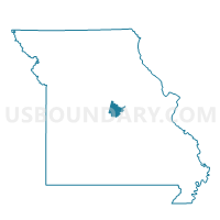
Eugene Voting District, Cole County, Missouri
About
Outline

Summary
| Unique Area Identifier | 607640 |
| Name | Eugene Voting District |
| County | Cole County |
| State | Missouri |
| Area (square miles) | 47.56 |
| Land Area (square miles) | 47.15 |
| Water Area (square miles) | 0.41 |
| % of Land Area | 99.13 |
| % of Water Area | 0.87 |
| Latitude of the Internal Point | 38.38203440 |
| Longtitude of the Internal Point | -92.32356520 |
Maps


Graphs
Select a template below for downloading or customizing gragh for Eugene Voting District, Cole County, Missouri


Neighbors
Neighoring Voting District (by Name) Neighboring Voting District on the Map
- Brazito Voting District, Cole County, MO
- Etterville Voting District, Miller County, MO
- Marys Home Voting District, Miller County, MO
- Russellville Voting District, Cole County, MO
- St. Elizabeth Voting District, Miller County, MO
- St. Thomas Voting District, Cole County, MO
- Wardsville Voting District, Cole County, MO
Top 10 Neighboring County Subdivision (by Population) Neighboring County Subdivision on the Map
- Saline township, Miller County, MO (8,315)
- Osage township, Cole County, MO (4,179)
- Clark township, Cole County, MO (3,707)
- Moreau township, Cole County, MO (2,786)
- Osage township, Miller County, MO (1,585)
- Jim Henry township, Miller County, MO (1,051)
Top 10 Neighboring Unified School District (by Population) Neighboring Unified School District on the Map
- Eldon R-I School District, MO (12,072)
- Osage County R-III School District, MO (6,495)
- Cole County R-II School District, MO (6,068)
- Cole County R-V School District, MO (4,962)
- Cole County R-I School District, MO (3,990)
- St. Elizabeth R-IV School District, MO (1,263)
Top 10 Neighboring State Legislative District Lower Chamber (by Population) Neighboring State Legislative District Lower Chamber on the Map
Top 10 Neighboring State Legislative District Upper Chamber (by Population) Neighboring State Legislative District Upper Chamber on the Map
Top 10 Neighboring 111th Congressional District (by Population) Neighboring 111th Congressional District on the Map
Top 10 Neighboring Census Tract (by Population) Neighboring Census Tract on the Map
- Census Tract 9625, Miller County, MO (5,656)
- Census Tract 202, Cole County, MO (4,158)
- Census Tract 9626, Miller County, MO (3,581)
- Census Tract 203, Cole County, MO (3,538)
- Census Tract 205, Cole County, MO (2,786)
Top 10 Neighboring 5-Digit ZIP Code Tabulation Area (by Population) Neighboring 5-Digit ZIP Code Tabulation Area on the Map
- 65101, MO (30,587)
- 65074, MO (3,061)
- 65032, MO (1,792)
- 65040, MO (1,208)
- 65058, MO (1,017)
- 65075, MO (784)
- 65064, MO (578)